The school project was presented in 2016 to Miur and Mibact and was successfully tested in six classes at two institutes (Avogadro in Turin and Erasmo da Rotterdam in Nichelino), with an 80-hour alternating school-work module involving 150 students. The contribution to Atlasfor thus realized was illustrated by the students in a public presentation on May 31, 2017.
On the occasion of the presentation of the initiative, it was written:
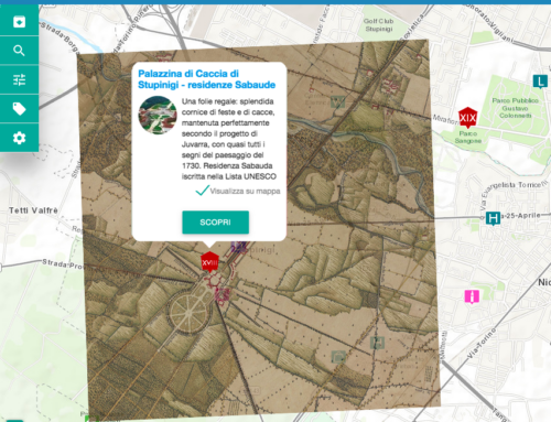
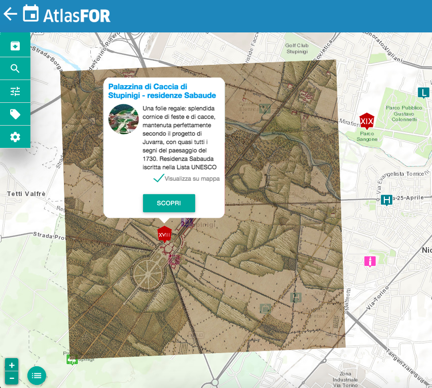
“The Landscapefor Cultural Association has developed Atlasfor, a free-access digital platform on the web, into which materials illustrating the cultural and environmental resources of the area are being progressively added. The platform can be explored as a georeferenced database in the form of directories (keywords), but especially as an atlas (see https://atlas.landscapefor.eu/ ).
On Atlasfor, iconographic documents that help to better understand the urban and non-urban landscape can be found free of charge, place by place and with ease: historical maps and photos, plans, frames of films set in those places, stories of inhabitants and events, works of art, activities and curiosities that may interest the visitor. The images are accompanied by short captions organized in such a way that for each place a prearranged narrative can be composed, read immediately even with a tablet or smartphone,
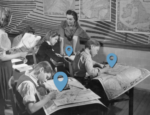
Students are optimal users of the atlas, which uses a medium they are familiar with such as the web, deploys images and a snappy language stimulates historical-geographical knowledge of the area.
The Atlasfor for School Project proposes to have students play not only the role of users but also that of “editors” of part of the Atlas. In fact, with the Project, which is included in the school-work alternation programs, students are put in a position to use Atlasfor’s software to produce research materials, organized in special compartments separate from the rest of the Atlas, according to a project shared between schools and the association, with the accompaniment of Landscapefor’s editorial staff and the coordination and assistance of school tutors.
Each school’s product, for the part deemed presentable by a special committee, can be published in the portion of Atlasfor accessible to all. Students become de facto editors of a portion of the Atlas. In this way they participate in an important cultural enterprise, acquiring elements of a professional methodological approach:
-for field research in the cultural-historical field,
-for the use of the web and dedicated programs (image processing and cartography),
-for communication and dissemination aspects (writing texts and their version in different languages).
The project for Schools was presented in 2016 to Miur and Mibact and was successfully tested in six classes of two Institutes (Avogadro in Turin and Erasmo da Rotterdam in Nichelino), with an 80-hour alternating school-work module involving 150 students. The contribution to Atlasfor thus realized was illustrated by the students in a public presentation on May 31, 2017.
For the 2017/18 school year, also in reference to the UN Year of Sustainable Tourism, a development of the project is proposed: to use the already tested module to have students present their local area to other students, in a network of reciprocity and exchanges between schools, to be activated at the national level.
Students in two classes from each participating school will enter materials into Atlasfor to illustrate 50 to 60 points of interest in their city (or a neighborhood, for larger cities), partly predefined and partly identified by the students themselves. These presentations, embedded in the network, are offered as a bid to organize educational trips and visits by other schools. They form the basis of a direct and possibly mutual exchange among the students who have worked on the Atlas, offering the others also feedback on the usefulness of their own product.
In order to achieve these results, systematic use of the network set up by Atlasfor is essential, which makes it possible to carry out the work of learning, research, editing, discussion and communication of the atlas materials almost completely online, with tools for dialogue, accompaniment and monitoring in real time, between students and external tutors or between students from different schools.
So on the one hand, the school-to-work alternation course is also offered to students as an experience of smart working, what is expected to be one of the modes that will become more widespread for intellectual work. The training part of the project is also delivered as e-learning, the mode that is now the fundamental tool of lifelong learning and the specific updates required for any placement in a productive activity. In this case it involves training and work tests at a distance, but assisted at all times by dedicated experts, and partly accompanied in the classroom by teachers.
On the other hand, the proposal stimulates students’ autonomy and “entrepreneurial” ability to document, inform themselves and elaborate in small groups (max 3 students) useful materials for documentation to be included in the atlas. In this aspect, too, this is an experiment that involves a certain gradualness: students are expected to train themselves to move mostly on their own in a research path of which, however, they are given the main references and due assistance. In the program, in fact, a choice of territories, main objects of attention and a “toolbox” are prepared in agreement with school tutors: a repertoire of historical cartographies, addresses of sites or archives equipped with images (with arrangements with local libraries), tutorials with ways to explore the territory directly, conduct interviews, shoot videos, etc.
The organizational modes of the program are directly goal-oriented: introducing to the ability to research and process images and texts to describe an area, the ability to work in an independent team, the modes of smart working and ‘e-learning.
In fact, in the program it is expected that the activities of the “operational” part will be carried out to a large extent (20/25 hours) on the territory, directed by the tutors but with independence of the children, outside school hours.
For the rest (particularly in the initial phase and in the tests to be conducted in the operational part, the activity takes place in the classroom (with provision of a computer with Internet access for every 3 students). Each school identifies and agrees with Landscapefor times and modes of activities, classroom occupancy, choosing whether during school hours or extra and with what teacher assistance, agreeing on dates and any adjustments to the program.
In the classroom, students may be assisted by a teacher who, during school hours, accompanies them, particularly for the parts of writing caption texts accompanying multimedia materials and for their translation into other languages.
Both in the classroom and on the ground, students have the continuous remote accompaniment and assistance of Landscapefor editors, who communicate by videoconference with each group in the classroom, and by text chat with all those who need it at any time.”